« Restaurants | Main | Travel Specials »
Saturday, September 30, 2006
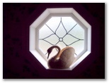
Shreveport KOA featured
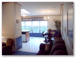
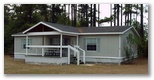
From our recent visit to Shreveport, we stayed at the Shreveport/Bossier City KOA in one of their large chalets (a mobile home). It was decorated attractively, came with a kitchen with two skylights, three bedrooms, perfect for a family or group gathering.
It
was a short trip, but we did have a chance to feast on the international
buffet at Sam's Town casino. For the freshest servings, be sure to get
there early (before 11 if going for lunch).
Our next features will
highlight more of our London travels. It has taken us longer to compile
the features, as we went to so many places and also took lots of
photographs.
Best,
Carl
Tuesday, August 15, 2006
Reminiscing about our Alaska travels
Have been watching the show Taste of America with Mark DeCarlo. Yes, I admit I watch the Travel Channel.
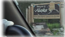
The episode on Alaska reminds me of our rustic Alaska Adventures a few
years ago where we drove to Alaska via RV along the Alaskan Highway
(everyone should do this at least once in their life to see the state up
close in all of its wonders and talk to the locals).
We
took a flying tour from Talkeetna for views of Mt. McKinley and landed on Ruth
Glacier. If you are ever near Tok, be sure to stop in at the Gateway
Salmon Bake and RV Park to feast on King salmon, halibut, ribs, reindeer
sausage, and buffalo burgers. We stayed several days in Tok at the RV
park while we waited for our mail to finally catch up with us. The
hottest thing in town is watching the sled dog demonstrations.
We were sad to hear that Susan Butcher, 4 time winner of the
1,100 mile Iditarod dog-sled race died recently. We had a chance to see
her as she talked to us at her house while training her dogs as we
cruised with the
Riverboat Discovery tour on the Chena and Tanana Rivers in Fairbanks. She
will be missed. Our thoughts and prayers go to her family and friends.
She was quite an Alaskan pioneer.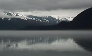
Watching glaciers crack and fall into the icy waters, viewing killer whales,
sea lions, harbor seals, seeing up close (but not too close) as wild
bears feast on salmon, touring Denali National Park, there is so much to
do and see in the grand and mysterious state. Read more about our
Alaska features in our state guides.
Carl
Edited on: Wednesday, August 16, 2006 12:25 AM
Categories: Destinations, RVing
Thursday, June 01, 2006
RV Resorts/Campgrounds Sections updated
Summer is almost here and everyone is getting ready to vacation, to see the fun sights. In gearing up for, we have updated our RV Resorts/Campgrounds Directory with the new format. Once our new content management system is in place, we will be able to offer many new services for classifieds, dynamic listings, etc. Look for more details soon.
